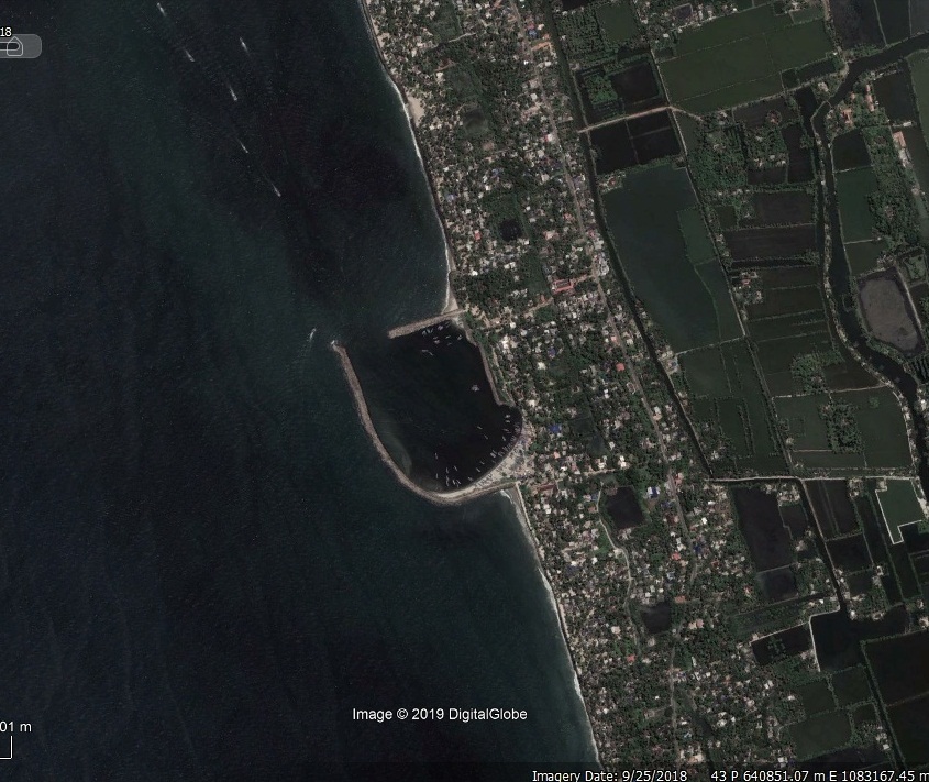
Chellanam Fishery Harbour


|
|
|
|
Type of Harbour |
Artificial Basin |
|
Location |
Latitude: 76 16 N |
|
Longitude: 9 58 E |
|
|
Nearest Town |
Ernakulam |
|
Road Access |
250mtr. west of Thoppumpady Chellanam State Highway and 8.5 km.From the N.H.47 at Eramalloor junction. |
|
Sanctioned date and amount |
Rs.500 lakhs vide G.O.(Rt).no.579/2007/F&PD dated.07.09.2007.Rs.2990 lakhs under NABARD assistance vide G.O.(Rt).No.13/2010/F&PD dated.04.01.2010. |
|
Salient Features |
|
|
Area of the Harbour basin(m2) |
350 x 200 m2 |
|
Length of breakwater(1) |
South Break water 570m |
|
Length of breakwater(2) |
North Breakwater 150m |
|
Land area available(m2) |
Nil |
|
Quay length (m) |
Nil |
|
Auction hall (m2) |
Nil |
|
Parking area in m2 |
Nil |
|
Internal road in m. |
Nil |
|
Other facilities available |
|
|
Chellanam Second stage Development |
Northern Break water is completed for 150m (120+30m).Southern break water between for a length of 570m is completed (120+450).20.23 acre land is to be acquired and other anciallary facilities such as auction hall , administrative building , locker room , Toilet block will be arranged after acquiring of required land. |

 Office of the Chief Engineer
 +91-0471-2459365
  +91-0471-2459365
 ce.hed@kerala.gov.in