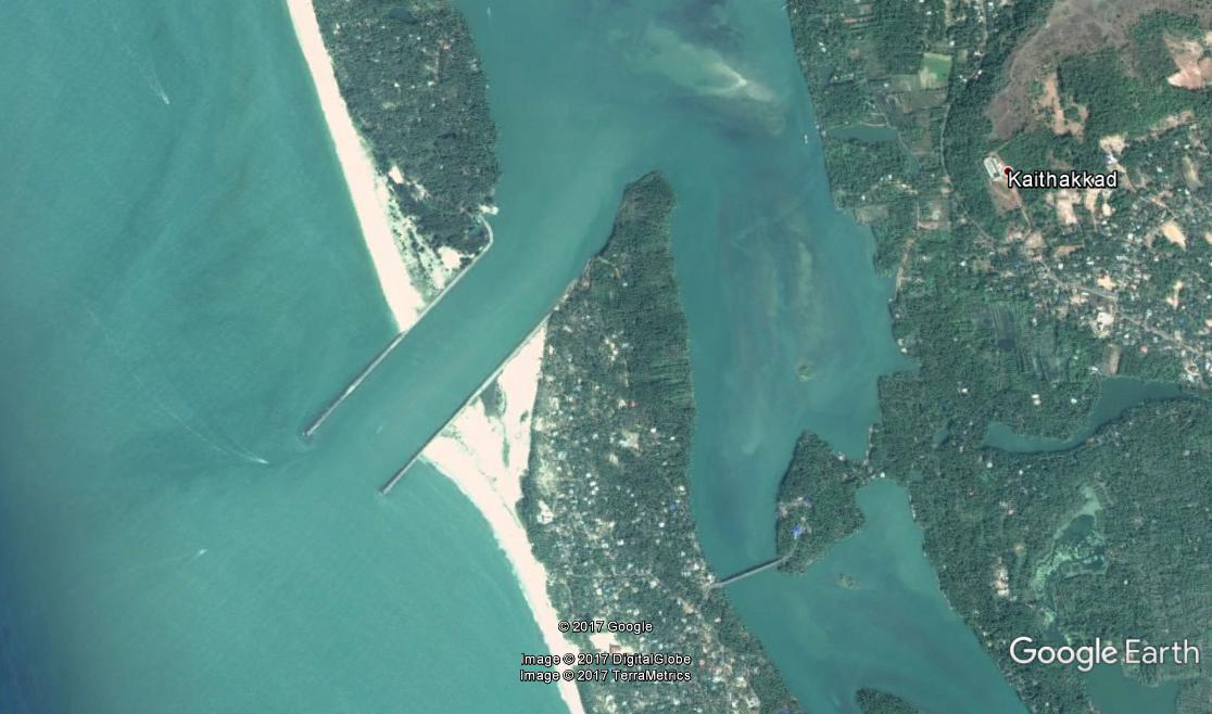
Cheruvathur Fishery Harbour


|
|
||
|
Type of Harbour |
Esturine |
|
|
Location |
Latitude: -12.2017 N |
|
|
Longitude: - 75.1289 E |
||
|
Nearst Town |
Cheruvathur |
|
|
Road Access |
6.00 Km to NH PWD/LSGD road exists. |
|
|
Sanctioned date and amount |
A S -. G O (ms) no. 36/ 2010/ F&PD, Tvm dt 15-5-2010 for Rs. 2906 lacs. (75% CSS ) [33013/3/06-Fy(H) dtd 25.02.2010 |
|
|
Salient Features |
|
|
|
Area of the harbour basin |
140 hectares |
|
|
Length of breakwater (1) |
803m( S) |
|
|
Length of breakwater (2) |
833m (N) |
|
|
Land area available |
2.5 hectares |
|
|
quay length (m) |
120m |
|
|
Auction hall (m2) |
900 m2 |
|
|
Parking area in m2 |
1650 m2 |
|
|
Internal road in m. |
150 m |
|
|
Other facilities available |
Gear shed, shops, canteen, rest shed , toilet facilities, Treatment plant,Water supply arrangements and electrification. |
|

 Office of the Chief Engineer
 +91-0471-2459365
  +91-0471-2459365
 ce.hed@kerala.gov.in